Riding the Southern Kettle Moraine State Forest in Wisconsin
Read about riding adventures in the Southern Kettle Moraine State Forest in Wisconsin, where riders can enjoy an obstacle course, over 50 miles of great trails, electric campsites and access to small towns and restaurants–– part of the Equitrekking 50 State Trail Riding Project.
by Patty Wisneski and Ada Duffey
The Kettle Moraine State Forest— Southern Unit is 61 miles east of Madison and 37 miles southwest of Milwaukee. The Wisconsin glacier formed Kettle Moraine 10,000 years ago. Kettles, or small ponds, were formed when giant blocks of ice were buried beneath gravel and soil. When the ice blocks melted, the gravel and soil fell through, creating holes or “kettles”. The Moraine is the high hills of soil and rock deposited by the glacier as it ground its way south and then receded. The trails take you through this unique collection of hills, ridges and depressions.
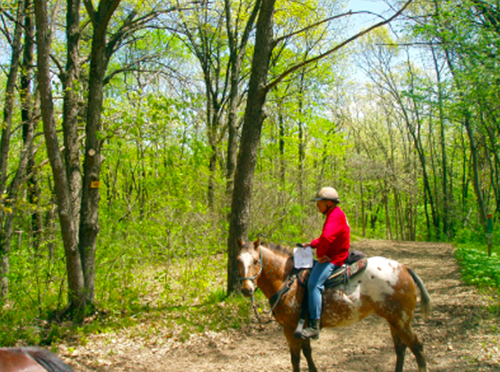
A horse enthusiast from the Southern Kettle Moraine Horse Trail Association.
The Moraine Ridge Trail, the main trail, runs the entire length of the Southern Kettle Moraine State Forest and is spread across three counties. Covering a distance of 33 miles, it is a horse trail that starts near County Highway C at the north end, and goes to County Highway P on the south end.
A Wisconsin State Parks and Forest vehicle sticker is required for parking and a trail pass is required for riding on the trails. A self-registration station is conveniently located in each horse trail parking lot.
There are several day parking lots spread through the Southern Kettle Moraine State Forest for horseback riders and carriage drivers, offering access from many different directions and a variety of loops to ride at each lot. Each trailhead offers different options and styles of trails.
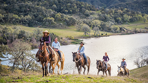
Riders enjoying the great outdoors from the Southern Kettle Moraine Horse Trail Association.
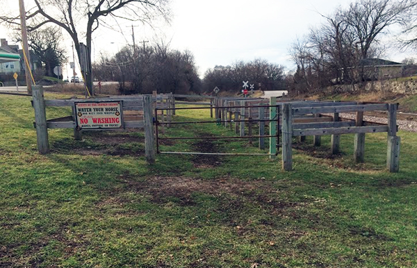
The Ottawa horses trails are mostly softer ground, but can be a little on the rocky side. Shoes are not necessary to ride these trails, but some horses may find themselves picking their way through sections, and shoes or boots may be a good option. This trailhead offers picnic tables, hitching posts, pit toilets and a water source, including a horse sized shower boom for hosing off your hard working equine.
The Ottawa trailhead is the most northeastern trailhead, closest to I 94, located east of highway 67 on ZZ. A series of loop trails in addition to the main trail allow riders to choose how long and how far they want to ride. With the shortest loop 2.5 miles, the longest at 8.6, endless combinations mean Ottawa provides endless possibilities. Just south of Wilton Road, (about five miles south of the trailhead) is a Mueller Homestead rest stop with a picnic table and portapotty.
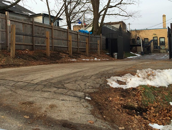
The trails at Eagle trails are beautiful and sandy, with few rocks, and the Town of Eagle offers a few unique and unusual places to explore. The trailhead offers pit toilets, numerous hitching posts, mounting blocks and picnic tables. Many campers love to ride from Horseriders Campground to the Eagle trails and stop for lunch at Suhmer's Saloon, a horse-friendly western bar, restaurant and motel. They have numerous tie stalls available. Coyote Canyon Grille now also has hitching posts behind its restaurant.
Hitching posts at Coyote Canyon Grille.
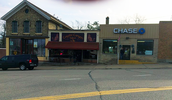
The front of Coyote Canyon, located at 105 W Main Street in Eagle, Wisconsin.
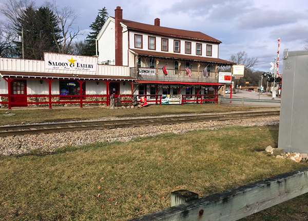
The front of Suhmer's Saloon Western Bar, Restaurant & Motel, located in the Heart of Eagle between Hwy 67 & Hwy 59.
The corrals at Suhmer's Saloon.
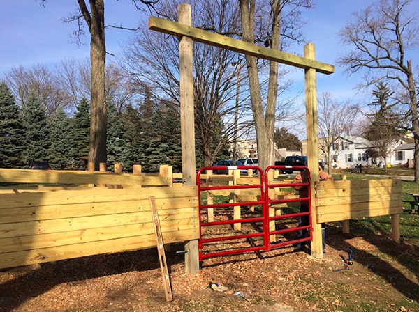
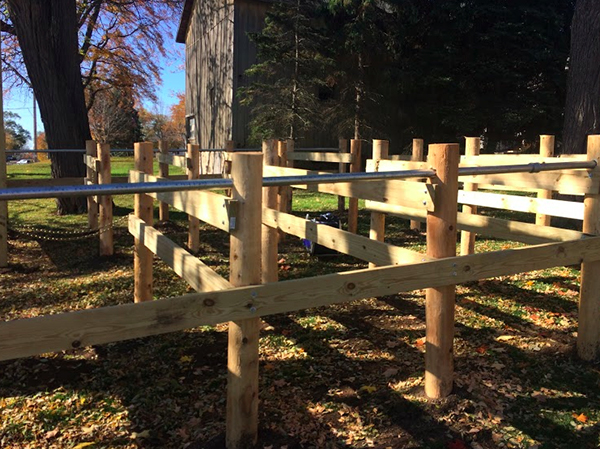
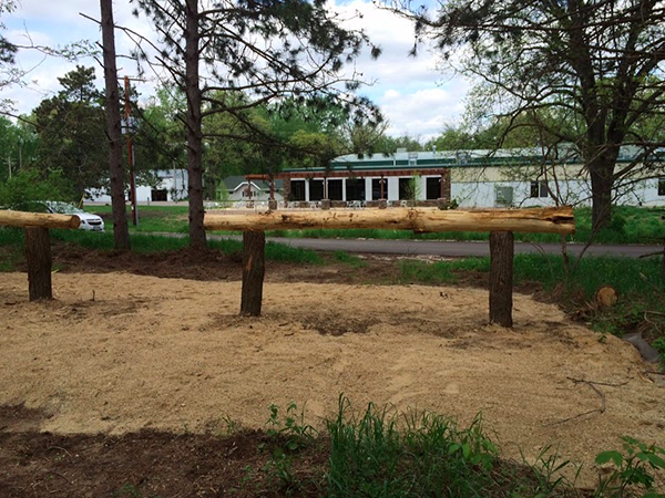
The Eagle Trailhead is located north of highway 67, on Hwy S, halfway between Ottawa and Palmyra trailheads. Somewhat less improved than Ottawa or Palmyra, Eagle is still often touted as one of the best spots in the system. Loop trails of 3-5 miles are accessible directly from the parking lot, as well as access to the main trail. South of the trailhead is a two mile obstacle course loop. The obstacle course includes: cowboy curtains, a bridge, a gate, two upright tractor tires, an L-back and sidepass, a telephone pole to step over or jump, a forehand, haunches and 360 turn, two steps about 8 eight feet apart and a weave in between 6 trees.
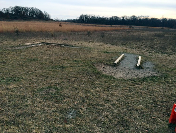
The L-back and sidepass, part of the obstacle course. The Southern Kettle Moraine has an obstacle course, over 50 miles of trails, electric campsites, access to small towns and restaurants and great trails.
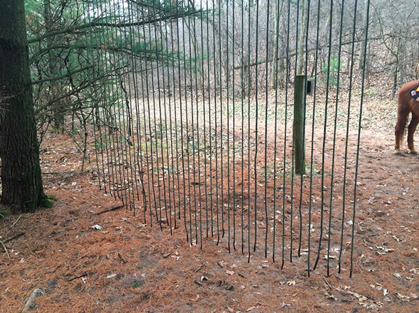
Rope cowboy curtin.
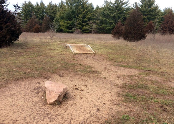
The bridge, part of the obstacle course.
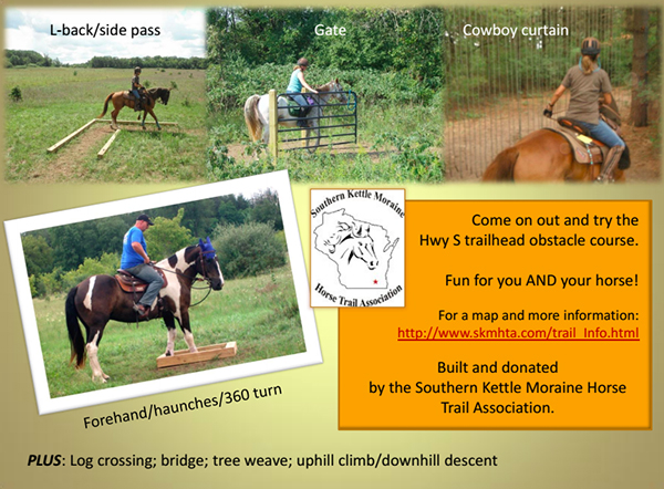
The Hwy S Obstacle Course was built by the Southern Kettle Moraine Horse Trail Association.
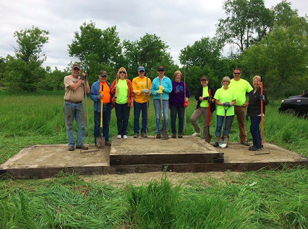
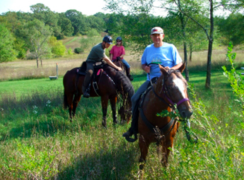
The step and members of the Southern Kettle Moraine Horse Trail Association.
The Horseriders Campground is at the Palmyra Trailhead. It can be found just outside the town of Palmyra, on Little Prairie Road, and includes a day parking area for those not wishing to spend the night. Notorious for being a difficult street to find, locals simply instruct: "from Hwy 59 in Palmyra, turn south at the Hardware Store, go over the railroad tracks, and the campground is on the left". This trailhead is strategically located in the center of the main bridle trail, giving campers and day riders full access to the entire system.
Palmyra corrals from the front.
Palmyra corrals from the side.
Immediately off the campground, there are several loop trails to explore, ranging from 4 to nearly 10 miles in length. Those looking for a longer ride can head north or south on the main trail. Many visitors love to ride to the Eagle trailhead, exploring loop trails along the way, stoping for lunch at a horse-friendly local establishment, relaxing a bit and riding back in time for dinner around the campfire.
On the way to the Eagle trails there is a Viele Road rest stop. There are three hitching posts, two picnic tables and for the last two years, a portapotty. The DNR plans to put a permanent pit toilet there. Also, on the way to Eagle, near to the campground, you can divert off the main trail to ride “the stairs.” They are a series of steps on an already steep hill.
Heading in the other direction from the campground, across Little Prairie Road, you can ride about an hour at a walk (about 4 miles) and take the Hwy H access trail to Rushing Waters. It is a trout farm just outside the forest. Last year, they introduced the Trout House – a wonderful horse friendly restaurant that includes two hitching posts!
Rushing Waters serves up trout grown in natural spring water ponds in the Kettle Moraine State Forest. For riders wishing to get here-- from Horseriders, cross Little Prairie Road and continue to the Hwy H access trail. (It will be on your right.) After about three quarters of a mile, you will get to a gravel road (Dahlin Road). Take the gravel road left until you get to Highway H. You will see Rushing Waters across the street and to your right. Remember a halter and lead rope!!
Heading another three miles further south, there is the Oleson Cabin. It offers a picnic table and hitching post for a rest.
Back at the campground, if you take a right at the Campground entrance, you can ride into town where there are 10 tie stalls a block off of Main St. (on 2nd and Wilson) and less than a mile from Horseriders Campground. On the way, there is also the Nite Cap Inn that is famous for its fish fry. They also have a hitching post. If you don’t feel like cooking breakfast, lunch or dinner, the Village of Palmyra restaurants have got you covered.
The Palmyra trails may have some rather rocky sections due to erosion, so shoes or boots are a good option. Check with other riders for suggestions on which trails to avoid if you do not have hoof protection for your horse and are concerned with trail conditions. Often the trails headed in the direction of the Eagle trailhead are less rocky than other trails heading out of the camp.
Running water, manure pits, wheelbarrows, hitching posts and pit toilets are stationed throughout the campground. There is also a covered shelter, commonly referred to as the pavilion, and a BBQ pit for group gatherings. The pavilion does have electric outlets, and is often used for potluck meals.
New in 2011 are nineteen campsites with electrical hookup. The sites are 401 through 406; 415; 417 through 421, and 431 through 437. There is an additional fee for these sites.
Horseriders Campground is the home of one of Wisconsin's best equestrian campgrounds and bridle trail systems. With direct access to over 54 miles of trails exploring the beauty of the Southern Kettle Moraine State Forest, a stay at this campground is a must for many riders and even those who drive. The campground is strategically located in the center of the main trail, giving campers full access to the entire system.
For riders that are not interested or prepared for camping, The Kettle Moraine Country Inn is just for you. It is a motel style bed and breakfast for you and your horse. It is located on Tamarack Road. It is just a few minutes drive from the campground and a short horse ride from the Tamarack Road access trail to the bridle path.
The LaGrange is the southernmost, and least improved of the trailheads. While little more than a parking lot, some shorter, yet very nice trails may be accessed at this point. There is a portapotty, but there is not any running water at this location. Heading south, there are some lovely rolling hills and grassy trails without the rocks that you find further north. It is not a heavily travelled horse trail, but you will have a lovely ride going to Hwy P and back. Be aware that your first goal will be to cross Highway 12, which has a 55 mile per hour speed limit. Although there is traffic, it is doable. It is worth crossing the road!
Heading north from the LaGrange trailhead, there are two loops available with long hills and a scenic Sweno Road access trail. Continuing north, you can make it all the way back to Horseriders Campground, passing the Oleson Cabin and Rushing Waters on the way. There are plenty of hills and flat areas along the way. There is a short (less than a mile) area where you will need to ride along Duffin Road. There is limited traffic on that road.
As you explore the Southern Kettle Moraine trail system, you will find resting areas with picnic tables and hitching posts, perfect for a lunch break or a rest in a shady spot, and a marked trail map showing your current location in the forest. At this time, there are no water sources along the trails other than at the Palmyra and Ottawa trail heads, so plan accordingly.
“There are many wonderful places in the world, but one of my favorite places is on the back of my horse.” Rolf Kopfle
Until next time – Happy Trails!
How you can go: Check out more links to the Southern Kettle Moraine State Forest DNR information, including the headquarters information and map and campground information–– and get more information from the Southern Kettle Moraine Horse Association.
About the authors: Patty Wisneski and Ada Duffey are horse enthusiasts in Wisconsin. Ada Duffey is an active member of the Southern Kettle Moraine Horse Association, which preserves and improves the state horse trails and campgrounds in the Southern Kettle Moraine State Forest. Patty Wisnewski also has an equestrian business, Celtic Horse Embroidery, which is committed to providing horse enthusiasts with casual clothing they are proud to wear.