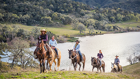
Horseback Riding Eastern Tennessee’s Cherokee National Forest-Part 3
Trail rider Dianne Noyes shares part three of great horse trails in the Cherokee National Forest, taking us on her favorite ride on Meadow Creek Mountain Trail as part of Equitrekking’s 50 State Trail Riding Project.
by Dianne Noyes
Read Part 2- Horseback Riding Eastern Tennessee’s Cherokee National Forest
Read Part 1- Horseback Riding Eastern Tennessee’s Cherokee National Forest
My Favorite Ride–Long Creek End of Meadow Creek Mountain Trail
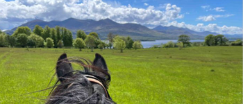
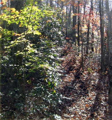
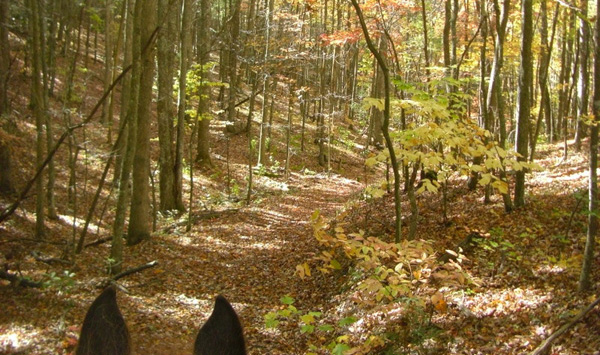
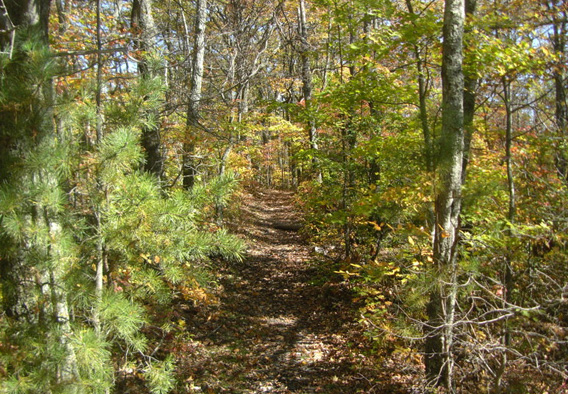
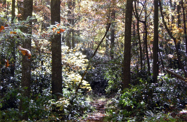
This is one of my favorite rides, an 18 mile round trip. Parking at the Meadow Creek Mountain fire tower saves my mount the 6-mile round trip up and down from the Burnett Gap Trailhead. I park at the fire tower parking lot and then pick up the Meadow Creek Mountain Trail coursing southeast from the bottom of the tower. I have been treated to a profusion of Pink Lady Slippers, Lily of the Valley, purple violets, some Yellow Dog Tooth Violets, purple rhododendrons, Flame Azaleas, Blood Wart and a hatch of yellow Swallowtail and blue Swallowtail butterflies.
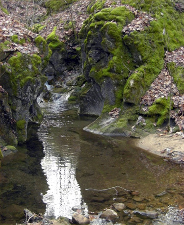
The views across the mountains of the Smokies are spectacular. The trail is challenging and fun. Follow the trail almost to the end where there are ancient carved rock formations in the limestone from the mountain stream. Water is plentiful for horses. Follow the forestry road back around the mountains to the fire tower and your trailer.
The Burnett Gap Trail
The Burnett Gap Trail was constructed to connect two trail systems:
1) Meadow Creek Mountain Trails (Gum Springs Trail, Mill Rock Hollow Trail and Meadow Creek Trail)
2) Paint Mountain Trails (Chimney Rock Trail, Paint Mountain Trail, Paint Rock Trail, and a parking area at Weavers Bend which all overlook the French Broad River)
The Meadow Creek Mountain Trail, a 14-mile linear trail along the crest of Meadow Creek Mountain, was impassible for many years due to washouts and blow downs. Over 360 Back Country Horsemen of East Tennessee volunteer hours were spent clearing and rebuilding this trail. Lumber and materials such as 1840 pounds of concrete and twenty five 3 in. by 6 in. by 8 ft. timbers were packed by horses or carried to the site in order to restore sections of Meadow Creek Trail on the eastern end, as was the trail by Tweed Springs near the old hotel. The connector, "Mill Creek Hollow Trail", has been completed to the Meadow Creek Trail to provide access to the "Meadow Creek Mountain Rustic Resort". At Old Forge the steps were repaired at the trailhead creek crossing.
Burnett Gap Trail (#510A)
Trail Elevation beginning: 1200 feet
Trail Elevation ending: 2,600 feet
Use: Horses, mountain biking, hiking
Difficulty: moderate to challenging
Average trail time: 8 hours
USGS Map: Paint Rock Quad
Recommended Season: Spring, Summer, Fall, Winter
Location: Greene/Cocke County, 18 miles south of Greeneville, Tennessee
Directions to Trailhead: From Greeneville, Tennessee, drive State Route 70 south for 9 miles. Turn west on State Route 107 south for 9 miles. Follow the forestry signage into the Burnett Gap Trailhead parking lot. The Burnett Gap Trailhead (#510A) has 11 miles of trails. Burnett Gap Trail exits the back of this parking lot through a forestry gate. Ride this forest road approximately one mile and follow the yellow blazes until you ascend steep switchbacks and arrive at a meadow.
Follow a grassy forest road approximately three miles to a "T" intersection and turn left at the carsonite sign. Descend this forest road approximately two miles and turn left at the "Y", cross through the creek and bear right. This road will end and become a trail that ascends a ridge. On top of the ridge descend along the roadway to Weavers Bend Road. To make this loop turn left for approximately two miles past Allen Branch Pond (#209) thru the forestry gate on the left and ride until the forest road ends. Turn right up a steep hill to the top of Brush Creek Mountain and follow the yellow blazes back to Burnett Gap Trail and turn right and follow back to the trailers.
Paint Mountain Trails (Chimney Rock Trail, Paint Mountain Trail, Paint Rock Trail, and a parking area at Weavers Bend which all overlook the French Broad River).
Chimney Rocks: (#154)
Length: 2.4 miles
Trail Elevation beginning: 1,200 feet
Trail Elevation ending: 2,600 feet
Use: Horses, mountain biking, hiking
Average trail time: 4-5 hours
USGS Map: Paint Rock Quad
Recommended season: Spring, Summer, Fall, Winter
Location: 18 miles south of Greeneville in Cocke County, Tennessee
Directions to Trailhead: From Greeneville, Tennessee, drive State Route 70 south for 9 miles. Turn west on State Route 107 south. At 8.5 miles, turn east on Brushy Creek Road (FDR 209). This is a narrow, winding, one lane paved road that courses along the edge of the spectacular Brushy Creek. Turn east on the first small dirt road over a bridge that presents itself, (FDR 209C). Continue on this dirt road 1 mile until a large parking lot for horse trailers will open on the south edge of this roadway just before crossing the railroad tracks at Weaver's Bend. A carsonite sign on the north edge of this roadway indicates the trailhead to Chimney Rocks.
Description: Paint Mountain Trail Loop #1: 4 hours
Look for the gate on the left just before the set of railroad tracks. The trail to Chimney Rocks begins on an old road and enters a large field after a short ride up a big hill. Continue straight ahead on the road for a half-mile until a small trail sign is reached where an old dead end road comes in from the left. Continue straight on and ride steeply up the crest of a ridge. The riding will become slightly less strenuous as a series of switchbacks is encountered. Ride through pines and hardwoods, wildflowers that may be seen are Spring Beauty, Smooth Yellow Violet and New England Aster.
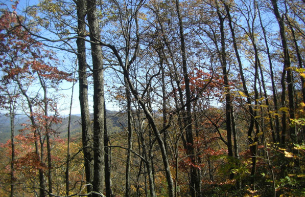
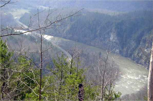
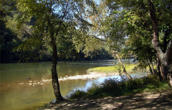
This trail climbs to the ridge top and rises almost continuously in elevation, a change of 1,400 feet, in a little over two miles. Here there are panoramic views of the French Broad River Basin. This is the best place to check out the fantastic views of the French Broad River as it meanders through Weaver’s Bend. Although this vista is great any time of year it is especially scenic during the winter months when the foliage is absent from the trees.
Follow Chimney Rocks Trail until it intersects with Paint Mountain Trail. Look for old wooden forestry signs. Turn left onto Paint Mountain Trail and follow along the mountain through the woods paying close attention to the yellow marks on the trees winding down to the French Broad River. Turn left on the gravel road and gait about one mile back to the trailers.
Description: Paint Rock Trail Loop #2: 6 hours.
To make a larger loop ride right at the Paint Rock Trail instead of the tight switchback on the left to Paint Mountain Trail, wind down the narrow, rough, old roadbed to Paint Rock. Ride right as this trail intersects with a very short strip of paved road and ride across the bridge.
This is where Paint Creek drains into the French Broad River. Look for Indian hieroglyphs on this cliff face along the river.
After enjoying lunch turn around and ride back over the bridge and take the left fork of the road past the trail where you came out onto this road. Ride on and this road will turn to gravel. Ride two hours all the way to the top. The views are spectacular and seen by very few. Ride past the first gate on the left and continue on to the second gate at the top, which is Lone Pine Gap. Turn left at this gate onto the Paint Mountain Trail. Follow this trail back down along the French Broad River and turn left for an easy one mile gait along a shaded dirt road back to the trailers.
Meadow Creek Mountain Trails (Gum Springs Trail, Mill Rock Hollow Trail and Meadow Creek Trail)
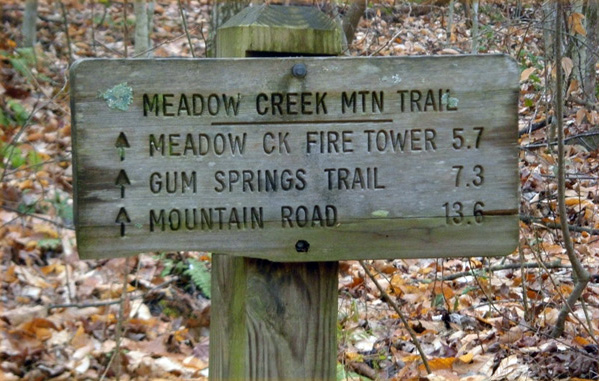
Location: Meadow Creek Mountain. Trails Illustrated Trail #6. 14.8 miles of yellow paint -blazed trail offering many scenic views. Parts of the trail are steep and/or narrow. Primitive campsites can be found along the trail. This trail has numerous access points, but we will only address three here;
(1) Cedar Creek Cave Road Trailhead parking lot
(2) Burnett Gap trailhead parking lot
(3) The southern end of Meadow Creek Mountain Trail at Long Creek trailhead, my favorite trail!
Directions:
(1) Cedar Creek Cave Road Trailhead parking lot: To access this trail from the north end drive State Route 70 south from Greeneville to South Greene High School where you make a right onto Cedar Creek Road (Country Road 1342). Travel 3.2 miles, then turn left onto another county road. After 0.2 miles take the gravel road on the left which leads to the trailhead parking (1.4 miles). Starting at the Cedar Creek Cave Road trailhead parking lot in Greene County, this trail climbs to the ridge-line of Chuckey Mountain, following the ridge-line it crosses the Gum Springs Trail and then follows the ridge-line of Meadow Creek Mountain to Forest Service Road #142 (Meadow Creek Mountain Road) where it continues on towards the southern end at Long Creek.
(2) Burnett Gap Trailhead parking lot: Starting at the Burnett Gap parking lot, ride to the west across State Route 107 and ascend Meadow Creek Fire Tower Road for a quarter mile, turn right onto Gum Springs Connector Trail (#5A) go a short distance to a meadow and follow the yellow blazes to the left and descend the trail, cross a creek and bear left at the "Y" and ride Gum Springs Trail (#5) to the top of the ridge and arrive at a crossroads. At this intersection, your choices are; 1) Turn left and ride along the top of this scenic ridge 1.7 miles to the Meadow Creek Fire Tower Road, turn left and ride 3 miles down on this scenic gravel road to return to the trailers. 2) Ride straight across to a junction (Tweed Springs Road) and keep right to go to the old Yellow Springs Hotel. Come back up this trail and bear to the left to the top of the ridge and loop right back to Gum Springs Trail.
(3) The southern end of Meadow Creek Mountain Trail at Long Creek Trailhead:
To access this trail from the south end drive from Newport, take US 25/70 for 4 miles, make a left on State Route 340 and after 1 mile turn right onto Long Creek Road (County Road 2576). The trailhead will be on the right in half a mile. Or, starting at the Burnett Gap parking lot, ride west across State Route 107 and ascend Meadow Creek Fire Tower Road passing the Meadow Creek Fire Tower on the left. After the tower turn left through the first forestry gate and follow a fire access road approximately one mile before one can find the Meadow Creek Mountain Trail on the right marked by an old wooden forestry sign and yellow paint on the trees. Continue to follow the trail along the crest of the mountain back down onto a saddle. Really look for the trail here because it is hard to find (look real hard for the yellow on trees to the right) and the trail loops back along the right around the mountain through the woods and follow the drainage left down. Follow the yellow marks to a forest road. Follow this out to the gate. One can then ride two ways. Ride right to follow Meadow Creek Fire Tower Road back up to the tower, OR left to the trailhead at Long Creek Road (County Road 2576) in Cocke County.
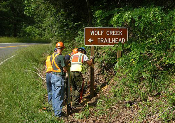
Wolf Creek Trailhead:
Location: Greene/Cocke County, 23 miles south of Greeneville TN
Directions: Drive south from Greeneville, Tennessee, on Highway 70, locally known as the Asheville Highway. Set trip counter at the last traffic light with Food City on the left and McDonalds on the right. Drive over the Nolichucky River and dam at 8.5 miles and turn west on State Route 107, which winds through Houston Valley. Cross the Greene/Cocke County line and turn east onto State Route 70/25, drive 3 miles and turn south at the "Wolfe Creek" sign onto Wolf Creek Road, turn right at Wolf Creek Church, then turn right on gravel road. Follow the signs to parking lot where trailhead begins. It is well signed.
Description: The old wagon road (an old county road cars used in the past to drive to the hamlet of "Wasp") to Wolfe Creek Water Fall was re-designated as a horse trail, widened and cleaned out. It provides access to an historical area and an extensive gravel road network which connects to the adjacent Pisgah National Forest. Wolfe Creek parking area was finished and direction signs to the trail head were installed in the summer of 2010 on State Route 25/70.
Read Part 2- Horseback Riding Eastern Tennessee’s Cherokee National Forest
Read Part 1- Horseback Riding Eastern Tennessee’s Cherokee National Forest
About the Author: Dianne Noyes, is a member of the Back Country Horsemen of East Tennessee. She is centrally located in the Cherokee in Greeneville, Tennessee with her dog Taylor, her cat Smokey, and her Tennessee Walking Horse Lance. When they are home, they spend a lot of time riding the trails of the Cherokee locating blow downs and washouts to the trails. These are reported for repair. Her second home is the 32-foot living quarters of her horse trailer. When not trail riding locally, she travels extensively with her little family throughout the United States and enjoys wilderness trail riding. Recently, Dianne spent the summer in the Allegany Mountains of northern Pennsylvania trail riding, camping and enjoying the country. She recently returned from a fall trip to Eminence, Missouri to ride in the Ozark Mountains. Her next planned excursion is to South Fork, Tennessee for the Thanksgiving horse vacation. The central location of the Cherokee National Forest makes riding close and yonder, easy!