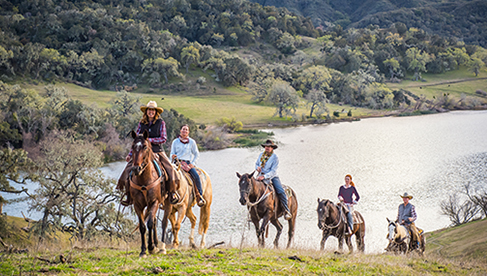
Horseback Riding Eastern Tennessee’s Cherokee National Forest-Part 2
Trail rider Dianne Noyes describes one of her favorite horse trails, Jennings Creek Trail, in the Cherokee National Forest as part of Equitrekking’s 50 State Trail Riding Project.
by Dianne Noyes
Read Part 1- Horseback Riding Eastern Tennessee’s Cherokee National Forest
Read Part 3- Horseback Riding Eastern Tennessee’s Cherokee National Forest
Old Forge Recreation Area - Jennings Creek Trail, Little Jennings Trail, Cowbell Hollow Trail, Poplar Cove Trail, Doctor's Ridge Trail
Almost Heaven: Jennings Creek Trail, A Favorite Horse Trail
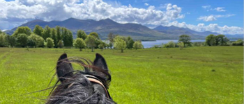
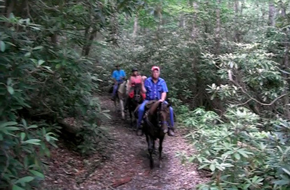
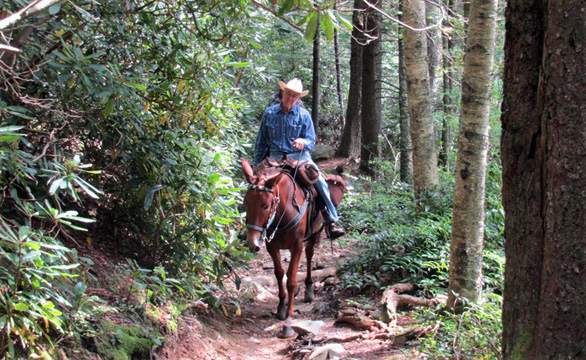
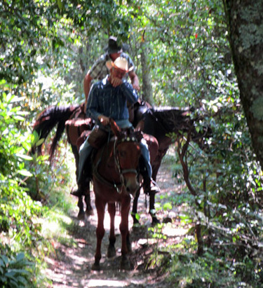
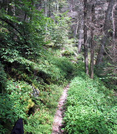
This is a favorite trail of mine. Although not a long horseback ride, it is challenging. This is the type of ride to pack one’s lunch and stop a lot to view the scenery and the flowers along the way. Plan to ascend Big Jennings Trail to the pavilion at Round Knob Picnic Area for lunch. This trailhead is marked with a carsonite sign for Jennings Creek.
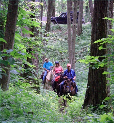
Leaving the Old Forge Campground one immediately crosses the creek, then crosses again in about .1 mile. At this second crossing one will see signs indicating that Big Jennings Creek Trail goes to the left, while the right fork is the trail for Little Jennings Trail. Take the left fork which has a more gradual climb.
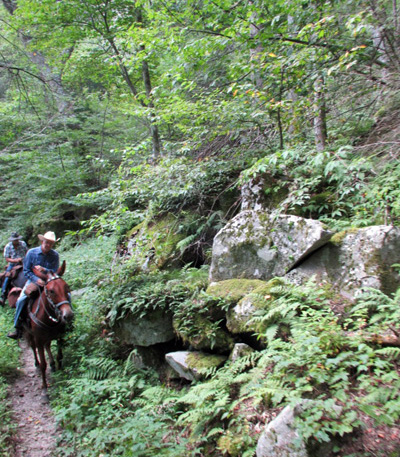
After 1.2 miles Big Jennings Creek Trail ends at the intersection with Poplar Cove Trail which enters from the left, and the Cowbell Hollow Trail which continues straight ahead. Do not attempt Poplar Cove Trail because it is a real gut buster for horses, climbing a straight trail up a steep mountain. Continue on Cowbell Hollow Trail, which leaves the creek and climbs steeply up the ridge through seven switchbacks.
At 1.6 miles is a very old sign pointing to Round Knob. After the switchbacks, the trail skirts the side of the ridge to the top of the ridge. As the trail starts to gradually descend one will pass the trailhead for Little Jennings Trail. Ride on for a short distance to the Round Knob Picnic Pavilion. Round Knob Picnic Pavilion is a little over 3 miles from Old Forge Campground.
After lunch, I then poke along the short Cowbell Hollow Trail and return to the Little Jennings Trail. Ride down along this creek bed. This trail follows an old railroad bed used for logging in the early 1900s. Look carefully for old cross ties and spikes. These three trails are now open again following the complete devastation done by the F-3 tornadoes that struck this area on April 26, 2011.
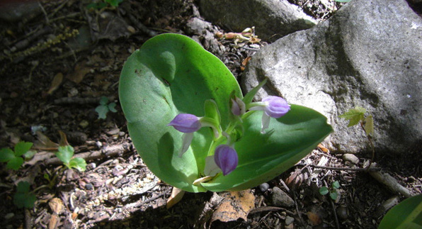
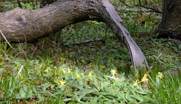
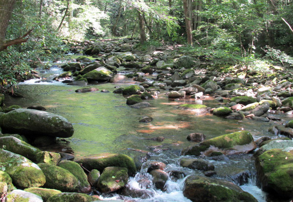
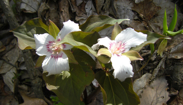
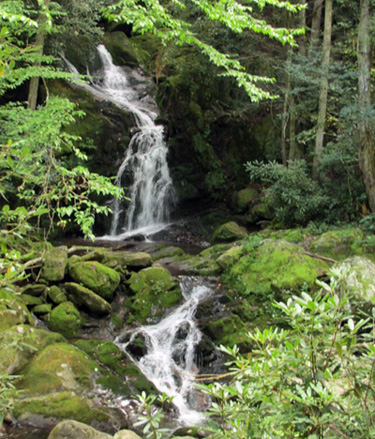
Most of the surrounding forest is mature second growth timber. The over story is a mix of Yellow Poplar, Cherry, Red Oak, Hemlock and White Pine White Trilliums bloom in profusion. The Tennessee State Flower “purple Crested Dwarf Iris” bloom profusely on green moss covered logs along the creek. Spring wildflowers include Wood Anemone, Solomon’s Seal, May Apples, Pink Lady Slippers, Bellwort and Smooth Yellow Violet, wild ginger and Galax. There are patches of purple violets banked against a background of green moss. Showy Orchid, Painted Trillium, Wild Hydrangea, blueberries, Dogtooth Violet, Yellow Miniature Lady Slippers, Wild Magnolias and Flame Azaleas bloom here. Look carefully through the clearings in the rhododendron for waterfalls and small cascades. These three trails are very rocky and the horses cross the two creeks many times.
Old Forge Recreation Area - Jennings Creek Trail, Little Jennings Trail, Cowbell Hollow Trail, Poplar Cove Trail, Doctor's Ridge Trail
Location: Greene County, Tennessee
Directions: Drive eastbound from Greeneville, Tennessee, on the State Route11E bypass. Drive past Wal-Mart Supercenter and turn right at the first traffic light onto State Route 107 towards Erwin. Drive State Route 107 (Erwin Highway) east for 5.1 miles to the brown forestry sign on the right. Turn right at this sign onto Horse Creek Park Road and drive two miles to the Horse Creek Recreation Area. Upon entering Horse Creek turn right immediately onto Old Forge Road (#331) and drive 2.8 miles to dead end at the Old Forge Campground. Parking is available along FDR #331 and at Old Forge Campground. This trail starts at the wooden archway to the left just before entering Old Forge Campground. Pass through this arch and cross Jennings Creek. One tenth of a mile after crossing the creek the Jennings Creek Trail will form a “Y” intersection with Little Jennings Trail. These two trails are connected by Cowbell Hollow Trail, creating a loop from Old Forge Campground up to Round Knob Picnic Pavilion and back down and around to Old Forge Campground. Description: This area, adjoining the Horse Creek Recreation Area, has numerous horse trails. There is horse camping available adjacent to both Horse Creek and Old Forge Campgrounds.
Jennings Creek Loop
This 6 mile loop ride encompasses three individual trails; the 1.0 mile Jennings Creek Trail (Forest Service Trail #21), the 2.0 mile Little Jennings Trail (Forest Service Trail #195) and the 1.8 mile Cowbell Hollow Trail (Forest Service Trail #24). This is a moderately difficult trail. It has multiple creek crossings, spectacular views, a lunch pavilion, and an elevation rise of 1235 feet.
Cowbell Hollow Trail (#24)
Cowbell Hollow Trail is moderately difficult. Beginning at Round Knob Recreation Area, this 1.8 mile trail ends at the junction with Jennings Creek Trail and Poplar Cove Trail. Parking is at Round Knob and Old Forge Recreation Areas.
Little Jennings Trail (#195)
Little Jennings Trail is moderately difficult. This trail begins at Jennings Creek Trail and extends 1.99 miles, where it intersects with Cowbell Hollow Trail. Parking is available at Round Knob and Old Forge Recreation Areas.
Poplar Cove Trail with 0.6 mile hike to Pete’s Branch Falls
Location: Greene County, Tennessee
Directions: Drive eastbound from Greeneville, Tennessee, on the State Route11E Bypass. Drive past Wal-Mart Supercenter and turn right at the first traffic light onto State Route 107 towards Erwin. Drive State Route 107 (Erwin Highway) east for 5.1 miles to the brown forestry sign on the right. Turn right at this sign onto Horse Creek Park Road and drive two miles to the Horse Creek Recreation Area.
Parking is available at both the Horse Creek Picnic Area AND from Old Forge Recreation Area; From Horse Creek ride FDR#94 (an ORV trail) for 1.1 miles. At this point, take the 4WD road that bears off to the right for 0.25 miles to the backcountry parking area. The trailhead for Poplar Cove Trail is on the right.
A more convenient access for those with large trailers is located at Old Forge Recreation Area. At Horse Creek drive FDR#133 to Old Forge Recreation Area. From this campground, ride Jennings Creek Trail (#21) 1.09 miles to the junction with Poplar Cove Trail(#22) and Cowbell Hollow Trail (#24).
Poplar Cove Trail with 0.6 mile hike to Pete’s Branch Falls
Description: (#22)-moderately difficult. 1.43 miles long. It has different access points at the Horse Creek Recreation Area off the four wheel drive road and at the Old Forge Recreation Area 1.09 miles up the Jennings Creek Trail. Parking is available at both entrances. This trail junctions at mile post .80 with Sarvis Cove Trail(#14) and serves as a connector between Horse Creek and Old Forge Recreation Areas. The trail closely follows Horse Creek for almost 1 mile until it intersects with Sarvis Cove Trail, where it leaves the creek to ascend the ridge and descend on the other side to a junction with Jennings Creek and Cowbell Hollow Trails. Along this ride, secure horses and indulge in a 0.6 mile hike to Pete’s Branch Falls, an easy hike following the blue blazes to these falls. Poplar Cove Trail passes through some old-growth yellow poplar stands and some mature, second growth red and white oak stands. The understory is composed of rhododendron and dogwood. A severe storm in the mid-70s felled some of the larger trees.
Doctors Ridge Trail
Location: Greene County, Tennessee
Directions: Drive eastbound from Greeneville, Tennessee, on the State Route11E Bypass. Drive past Wal-Mart Super center and turn right at the first traffic light onto State Route 107 towards Erwin. Drive State Route 107 (Erwin Highway) east for 5.1 miles to the brown forestry sign on the right. Turn right at this sign onto Horse Creek Park Road and drive two miles to the Horse Creek Recreation Area. Upon entering Horse Creek turn right immediately onto Old Forge Road (#331) and drive 1.9 miles to the Doctor’s Ridge Trailhead on the right. Parking is available for small horse trailers along Old Forge Road (#331) and at Old Forge Campground.
Description: (#194) easy. A 1.13 mile trail is fairly steep in some areas, but wide and easy to follow. Doctors Ridge Trail begins on FDR#331 and ends on Greystone Road. Roadside parking is available at two locations: on Old Forge Road and at the end of the trail on Greystone Road. Tree species along the trail are red maple, cherry, oak, black gum, white oak, sour wood and hickory.
Bullen Hollow Trailhead
Location: Greene Mountain. Trails Illustrated trail #2
Directions: From Greeneville, take State Route 107 heading southeast for 6 miles. Follow signs to Horse Creek Recreation Area until you reach Greystone Road on your right. Follow Greystone Road to Shelton Mission Road on your left. Take Shelton Mission Road for 2.2 miles to the trailhead.
Description: 2.68 miles of trail (yellow blazes) with an elevation change of almost 2,000 feet link the trailhead on Shelton Mission Road to Low Gap on Little Bald Mountain. A primitive campsite is located at the junction of Bullen Hollow Trail and Margarette Falls Trail (the latter trail is for hiker use only).
Read Part 1- Horseback Riding Eastern Tennessee’s Cherokee National Forest
Read Part 3- Horseback Riding Eastern Tennessee’s Cherokee National Forest
About the Author: Dianne Noyes, is a member of the Back Country Horsemen of East Tennessee. She is centrally located in the Cherokee in Greeneville, Tennessee with her dog Taylor, her cat Smokey, and her Tennessee Walking Horse Lance. When they are home, they spend a lot of time riding the trails of the Cherokee locating blow downs and washouts to the trails. These are reported for repair. Her second home is the 32-foot living quarters of her horse trailer. When not trail riding locally, she travels extensively with her little family throughout the United States and enjoys wilderness trail riding. Recently, Dianne spent the summer in the Allegany Mountains of northern Pennsylvania trail riding, camping and enjoying the country. She recently returned from a fall trip to Eminence, Missouri to ride in the Ozark Mountains. Her next planned excursion is to South Fork, Tennessee for the Thanksgiving horse vacation. The central location of the Cherokee National Forest makes riding close and yonder, easy!